GROUND WATER ATLAS of the UNITED STATES
California, Nevada
HA 730-B
Coastal Basins aquifers
There are two different files for each illustration
- A 72 ppi GIF file, suitable for screen viewing is accessed through
the thumbnail image
- An eps file, suitable for downloading to be printed or edited is accessed
through the "eps file" link. Most files are Adobe Illustrator
5.5, exceptions are noted. These files have been compressed with GNU's gzip
utility. If your web browser defaults to a screen display of the file, turn
on the "Load to local disk" option before downloading. Download
and process these eps files as ascii, not binary.
Santa Clara Valley
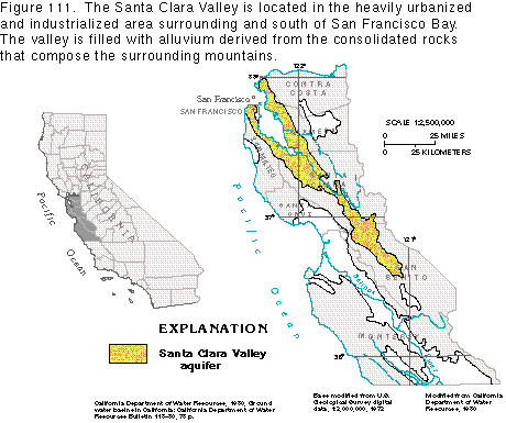
Figure 111 Map of Santa Clara Valley area (16K)
 editable eps
file b111.eps.gz (79K compressed)
editable eps
file b111.eps.gz (79K compressed)
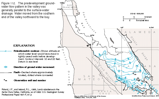
Figure 112 Map of potentiometric contours (22K)
 editable eps
file b112.eps.gz (81K compressed)
editable eps
file b112.eps.gz (81K compressed)
Figure 113 Map of ground-water level change (25K)
 editable eps
file b113.eps.gz (115K compressed)
editable eps
file b113.eps.gz (115K compressed)
Figure 114 Graph of water-level declines, surface-water imports, subsidence,
... (15K)
 editable
eps
file b114.eps.gz (20K compressed)
editable
eps
file b114.eps.gz (20K compressed)
Figure 115 Map of subsidence (23K)
 editable
eps
file b115.eps.gz (86K compressed)
editable
eps
file b115.eps.gz (86K compressed)
 editable eps
file b112.eps.gz (81K compressed)
editable eps
file b112.eps.gz (81K compressed) 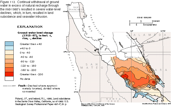 editable eps
file b113.eps.gz (115K compressed)
editable eps
file b113.eps.gz (115K compressed) 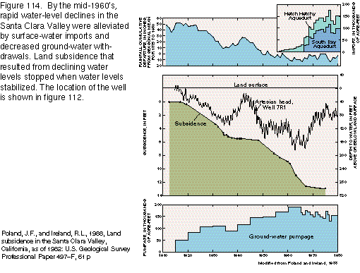 editable
eps
file b114.eps.gz (20K compressed)
editable
eps
file b114.eps.gz (20K compressed)  editable
eps
file b115.eps.gz (86K compressed)
editable
eps
file b115.eps.gz (86K compressed)