 downloadable tiff file C116.tif.gz (2.6MB
compressed)
downloadable tiff file C116.tif.gz (2.6MB
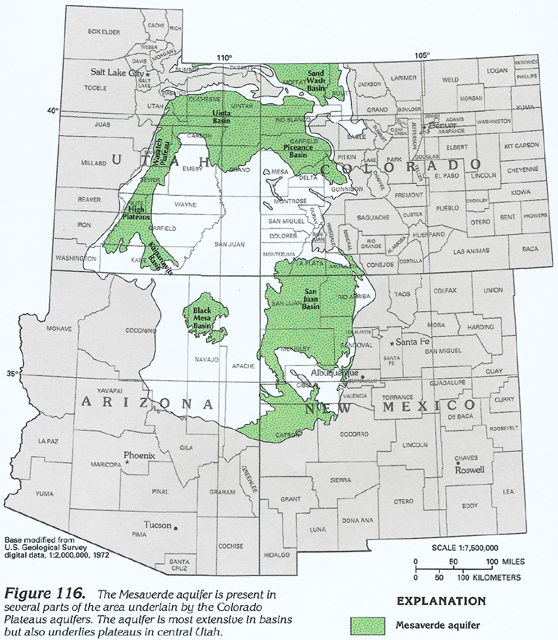
compressed) Figure 116 Map showing the location of the Mesaverde
aquifer (340K)
downloadable tiff file C116.tif.gz (2.6MB
compressed)
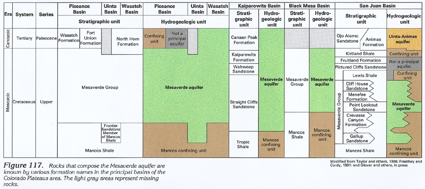
Figure 117 Correlation chart showing the geologic and
hydrogeologic characteristics of the Mesaverde aquifer (352K)
 downloadable tiff file C117.tif.gz (2.6MB
compressed)
downloadable tiff file C117.tif.gz (2.6MB
compressed)
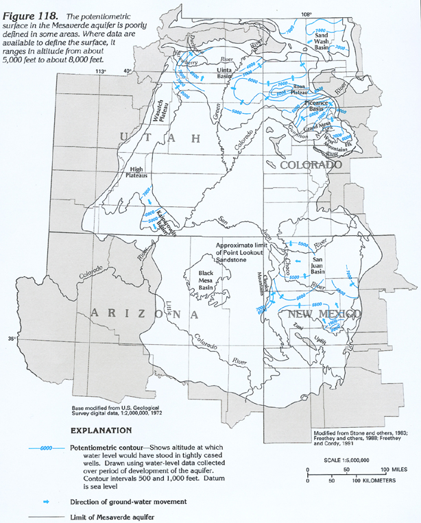
Figure 118 Map showing the potentiometric surface of the Mesaverde
aquifer (396K)
 downloadable tiff file C118.tif.gz (2.6MB
compressed)
downloadable tiff file C118.tif.gz (2.6MB
compressed)
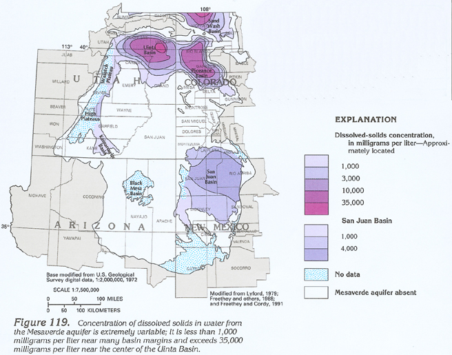
Figure 119 Map showing the concentrations of dissolved solids
in water from the Mesaverde aquifer (276K)
 downloadable tiff file C119.tif.gz (1.9MB
compressed)
downloadable tiff file C119.tif.gz (1.9MB
compressed)