 downloadable tiff file C129.tif.gz (2.6MB
compressed)
downloadable tiff file C129.tif.gz (2.6MB
compressed) Figure 129 Map showing location of the Coconino-De Chelly
Aquifer (340K)
downloadable tiff file C129.tif.gz (2.6MB
compressed)
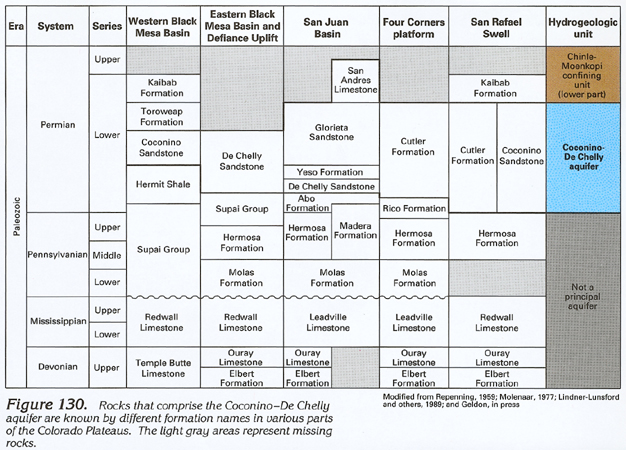
Figure 130 Correlation chart showing the geologic and
hydrogeologic characteristics of the Coconino-De Chelly Aquifer
(264K)
 downloadable tiff file C130.tif.gz (1.9MB
compressed)
downloadable tiff file C130.tif.gz (1.9MB
compressed)
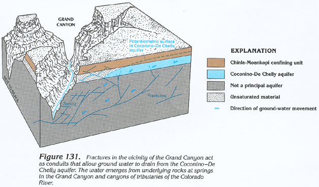 downloadable tiff file C131.tif.gz (1.5MB
compressed)
downloadable tiff file C131.tif.gz (1.5MB
compressed) Figure 132 Map showing the potentiometric contour and
ground-water movement in the Coconino-De Chelly aquifer (284K)
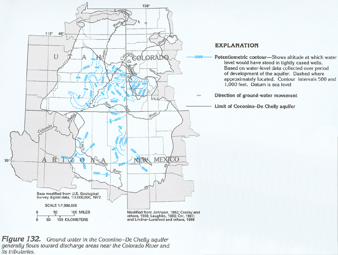 downloadable tiff file C132.tif.gz (1.8MB
compressed)
downloadable tiff file C132.tif.gz (1.8MB
compressed)
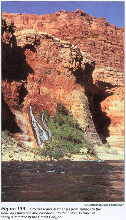
Figure 133 Photograph showing the ground water discharges from
springs in the Redwall Limestone in the Grand Canyon (432K)
 downloadable tiff file C133.tif.gz (3.6MB
compressed)
downloadable tiff file C133.tif.gz (3.6MB
compressed)
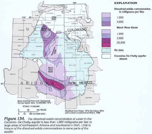
Figure 134 Map showing the dissolved-solids concentrations
in water from the Coconino-De Chelly aquifer (292K)
 downloadable tiff file C134.tif.gz (2MB
compressed)
downloadable tiff file C134.tif.gz (2MB
compressed)