GROUND WATER ATLAS of the UNITED STATES
Montana, North Dakota, South Dakota, Wyoming
HA 730-I
Regional summary
There are two different files for each illustration
- A 72 ppi GIF file, suitable for screen viewing is accessed through
the thumbnail image
- An eps file, suitable for downloading to be printed or edited is accessed
through the "eps file" link. Most files are Adobe Illustrator
6.0, exceptions are noted. These files have been compressed with GNU's
gzip utility. If your web browser defaults to a screen display of the file,
turn on the "Load to local disk" option before downloading. Download
and process these eps files as ascii, not binary.
Areal distribution of aquifers
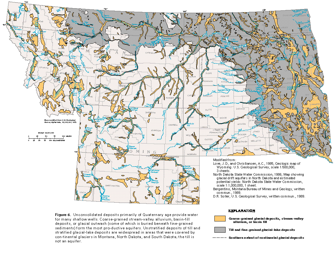
Figure 6 Map of glacial deposits (132K)
 editable eps
file I006.eps.gz (990K compressed)
editable eps
file I006.eps.gz (990K compressed)
Figure 7 Map of principal aquifers (248K)
 editable eps
file I007.eps.gz (2.1M compressed)
editable eps
file I007.eps.gz (2.1M compressed)
Figure 8 Map of regional aquifer systems (17K)
 editable eps
file I008.eps.gz (116K compressed)
editable eps
file I008.eps.gz (116K compressed)
Figure 9 Diagram of overlapping aquifers of the Northern
Great Plains aquifer system (33K)
 editable eps
file I009.eps.gz (1.1M compressed)
editable eps
file I009.eps.gz (1.1M compressed)
 editable eps
file I006.eps.gz (990K compressed)
editable eps
file I006.eps.gz (990K compressed) 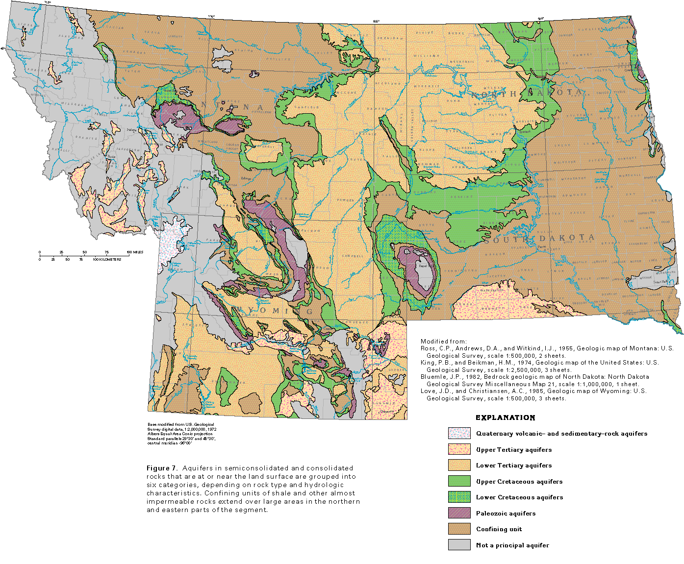 editable eps
file I007.eps.gz (2.1M compressed)
editable eps
file I007.eps.gz (2.1M compressed) 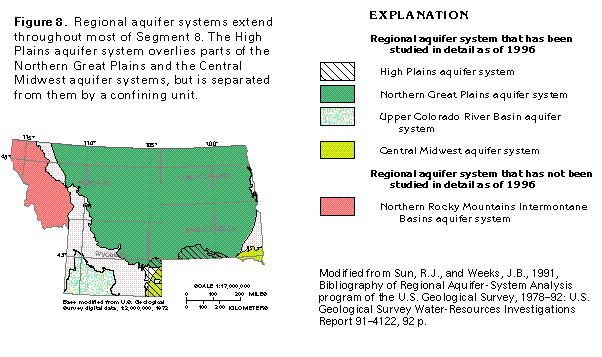 editable eps
file I008.eps.gz (116K compressed)
editable eps
file I008.eps.gz (116K compressed)