GROUND WATER ATLAS of the UNITED STATES
Delaware, Maryland, New Jersey, North Carolina, Pennsylvania, Virginia,
West Virginia
HA 730-L
North Atlantic Coastal Plain aquifer system
There are two different files for each illustration
- A 72 ppi GIF file, suitable for screen viewing is accessed through
the thumbnail image
- An eps file, suitable for downloading to be printed or edited is accessed
through the "eps file" link. Most files are Adobe Illustrator
6.0, exceptions are noted. These files have been compressed with GNU's
gzip utility. If your web browser defaults to a screen display of the file,
turn on the "Load to local disk" option before downloading. Download
and process these eps files as ascii, not binary.
Introduction
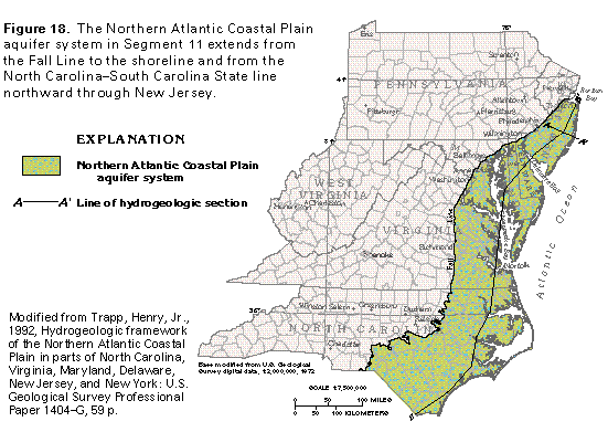
Figure 18 Map of aquifer system (33K)
 editable eps file L018.eps.gz
(248K compressed)
editable eps file L018.eps.gz
(248K compressed)
Figure 19 Hydrogeologic section (17K)
 editable eps file L019.eps.gz
(33K compressed)
editable eps file L019.eps.gz
(33K compressed)
Figure 20 Hydrogeologic section (50K)
 editable eps file L020.eps.gz
(50K compressed)
editable eps file L020.eps.gz
(50K compressed)
Figure 21 Correlation chart (50K)
 editable eps file L021.eps.gz
(50K compressed)
editable eps file L021.eps.gz
(50K compressed)
 editable eps file L018.eps.gz
(248K compressed)
editable eps file L018.eps.gz
(248K compressed)  editable eps file L019.eps.gz
(33K compressed)
editable eps file L019.eps.gz
(33K compressed) 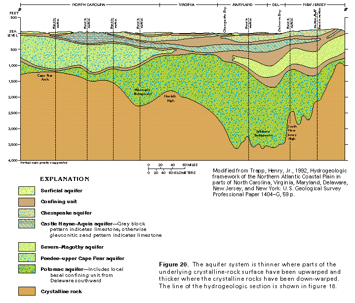 editable eps file L020.eps.gz
(50K compressed)
editable eps file L020.eps.gz
(50K compressed) 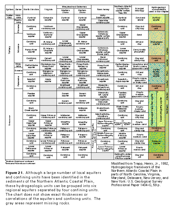 editable eps file L021.eps.gz
(50K compressed)
editable eps file L021.eps.gz
(50K compressed)