GROUND WATER ATLAS of the UNITED STATES
Alaska, Hawaii, Puerto Rico and the U. S. Virgin Islands
HA 730-N
Puerto Rico and the U. S. Virgin Islands North Coast Limestone
aquifer system
There are two different files for each illustration
- A 72 ppi GIF file, suitable for screen viewing is accessed
through the thumbnail image.
- An eps file, suitable for downloading to be printed or edited
is accessed through the "eps file" link. Most files
are Adobe Illustrator 6.0, exceptions are noted. These files
have been compressed with GNU's gzip utility. If your web browser
defaults to a screen display of the file, turn on the "Load
to local disk" option before downloading. Download and process
these eps files as ascii, not binary.
Hydraulic Properties
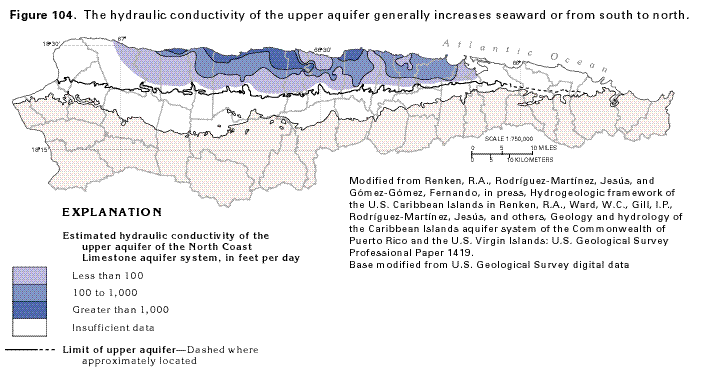
Figure 104 Map showing the estimated hydraulic conductivity
of the upper aquifer of the North Coast Limestone aquifer system
(26K)
 editable eps file N104.eps.gz
(105K compressed)
editable eps file N104.eps.gz
(105K compressed)
Figure 105 Map showing the estimated transmissivity
of the upper aquifer of the North Coast Limestone aquifer system
(27K)
 editable eps file N105.eps.gz
(106K compressed)
editable eps file N105.eps.gz
(106K compressed)
Figure 106 Map showing the estimated transmissivity
of the lower aquifer of the North Coast Limestone aquifer system
(27K)
 editable eps file N106.eps.gz
(146K compressed)
editable eps file N106.eps.gz
(146K compressed)
 editable eps file N104.eps.gz
(105K compressed)
editable eps file N104.eps.gz
(105K compressed) 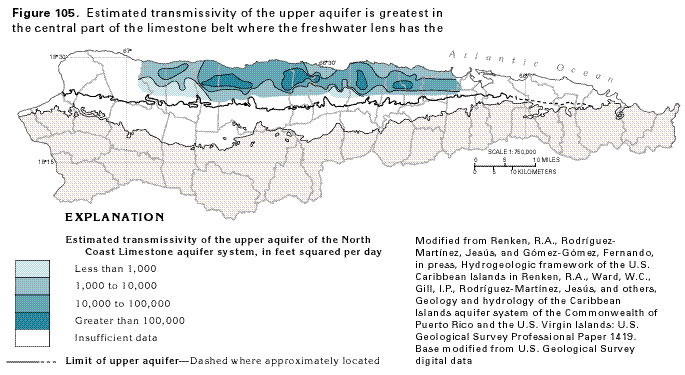 editable eps file N105.eps.gz
(106K compressed)
editable eps file N105.eps.gz
(106K compressed) 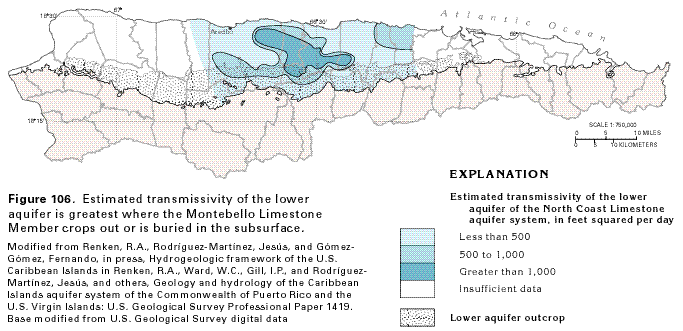 editable eps file N106.eps.gz
(146K compressed)
editable eps file N106.eps.gz
(146K compressed)